Download: preprint.pdf
Summary
This work investigated the spatial continuity of surface heat flow near subduction zones. We compared two different interpolations methods, Similarity and Kriging with surface heat flow data from the Global Heat Flow Data Assessment Group et al. (2024). Our analysis showed that along-strike surface heat flow continuity near subduction zones is ambiguous or geographically limited, not globally uniform.
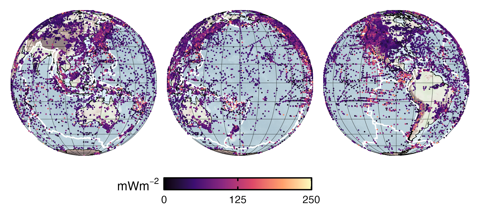
Figure: Global surface heat flow observations. A total of 91,182 raw, unfiltered surface heat flow observations were used for spatial analysis. Filtered and deduplicated data within 34 domains near subduction zones ($N_\mathrm{obs}$ = 60,316 total) show uneven, irregular distributions regionally and globally. Note the relatively high observation density in N America and around the N Pacific compared to the S Pacific.
Coauthors
- Matthew Kohn (Boise State University)
Acknowledgement
We express our sincere gratitude to the communities, institutions, and research teams who develop and maintain the open-source datasets used in this study. Specifically, we thank the creators of the SubMap tool (Géosciences Montpellier); the University of Texas Institute for Geophysics for the plate boundary compilation; the NOAA National Centers for Environmental Information for the ETOPO 2022 global relief model; the Global Heat Flow Data Assessment Group for maintaining the Global Heat Flow Database; and F. Lucazeau for providing the Similarity interpolations. This work was supported by the National Science Foundation grants OIA 1545903 to M. Kohn, S. Penniston-Dorland, and M. Feineman and EAR 2118114 to M. Kohn.
Open Research
All data, code, and relevant information for reproducing this work are archived on the OSF (Kerswell, 2026a) and Zenodo (Kerswell, 2026b) repositories. All code within these repositories is MIT Licensed and free for use and distribution (see license details). All spatial datasets used in this study are open-source: transects from the SubMap tool version 7.1 (Lallemand et al., 2026); present-day plate boundaries from Coffin et al. (2018); global relief model from NOAA National Centers for Environmental Information (2022); surface heat flow observations from the Global Heat Flow Data Assessment Group et al. (2024); and Similarity interpolations from Lucazeau (2019).